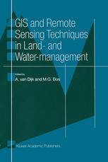
「GIS电子书」 GIS and Remote Sensing Techniques in Land- and Water-management(PDF版本)
这本书介绍了地理信息系统(GIS)和遥感技术在土地和水资源管理中的应用。 书中用七个实际例子说明了GIS和遥感技术如何帮助监测和预测资源利用的影响,提供可靠的信息,以及快速地处理和分析数据。这些例子涉及灌溉管理、阿拉尔海的救援、水质检测、水文模型、洪水波测量、土壤湿度监测和GIS在水资源管理中的发展趋势
内容简介
Managing land and water is a complex affair. Decisions must be made constantly to allocate and use natural resources. Decision and action in any use of resources often have strong interactions and side-effects on others, therefore it is extremely important to monitor and forecast the impacts of the decisions very carefully. Reliable information and clear data manipulation procedures are compulsory for monitoring and forecasting. Remote Sensing has considerable potential to provide reliable information. A Geographic Information System is an easy tool for manipulating and analysing the data in a clear and fast way. This book describes in seven practical examples how GIS and Remote Sensing techniques are successfully applied in land and water management.
基础信息

作者: Marinus G. Bos (auth.), A. van Dijk, M. G. Bos (eds.)
出版商: Springer Netherlands
出版时间: 2001
ISBN编号: 978-94-010-6492-7,978-94-009-0005-9
下载本书
 为了防止资源恶意爬取导致被和谐,此处内容被作者隐藏。
关注本站微信公众号,回复“资源下载”,获取验证码。
在微信里搜索“麻辣GIS”或微信扫描右侧二维码即可关注本站微信公众号。
求书 & 分享
如果这里没找到您所以需要的书籍,可以在本文下方留言,并留下您的邮箱,后续有相关资源后会分享给你。
如果您也有相应的书籍可以分享,可以将分享链接放在本文下方留言板中,替其他小伙伴先谢谢你啦~
相关阅读
声明
1.本文所分享的所有需要用户下载使用的内容(包括但不限于软件、数据、图片)来自于网络或者麻辣GIS粉丝自行分享,版权归该下载资源的合法拥有者所有,如有侵权请第一时间联系本站删除。
2.下载内容仅限个人学习使用,请切勿用作商用等其他用途,否则后果自负。


![[论文品鉴]海洋温度场的三维可视化](https://image.malagis.com/map523.jpg?imageView2/1/w/100/h/70)
![[3S资源] 遥感手册(Remote Sensing Handbook)2016版三卷打包下载](http://image.malagis.com/pic/gis/2016-10-10_19_15_28_1476098128.26513.jpg?imageView2/1/w/100/h/70)


