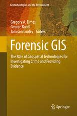
「GIS电子书」 Forensic GIS: The Role of Geospatial Technologies for Investigating Crime and Providing Evidence(PDF版本)
发布时间: 2023-03-08
所属分类: GIS书籍
各种学科和职业都采用GIS来收集、存储、操作、分析和展示空间数据,也包括调查犯罪、起诉和定罪罪犯等。各类GIS的应用、可接受性、相关性和程序合法性都不同。
本书的目的是解释地理空间技术的性质,展示用于调查和诉讼民事和刑事活动的各种地理空间应用,并提供目前地理空间技术在证据制作中的可接受性参考。
本书是一本介绍性概述,作者是跨学科和职业的研究人员和实践者,也是该领域的专家。
内容简介
- Concepts, Principles, and Definitions
- Geospatial Technologies in the Courtroom
- Spatial Tracking Applications
- Spatial Technology Applications
- Using Near Repeat Analysis for Investigating Mortgage Fraud and Predatory Lending
- State Registration of Sex Offenders: Public Notification, Web Mapping, and Spatial Issues
- The SDIK Police Model: How to Make the Invisible Visible
- Spatial Analysis of Fear of Crime and Police Calls for Service: An Example and Implications for Community Policing
- Using GIS to Monitor and Investigate Police Use of Force: The Spatial Distribution of Force Factors
- Mapping Spatiotemporal Patterns of Liquor Law Violation Citations During Oktoberfest in College Town of La Crosse, Wisconsin
- A Web-Based GIS for Crime Mapping and Decision Support
- Use of Geographically Weighted Regression on Ecology of Crime, Response to Hurricane in Miami, Florida
- Delineating Legal Forest Boundaries to Combat Illegal Forest Encroachments: A Case Study in Murree Forest Division, Pakistan
基础信息

作者: Gregory A. Elmes, George Roedl, Jamison Conley (eds.)
Series: Geotechnologies and the Environment 11
出版商: Springer Netherlands
出版时间: 2014
下载本书
 为了防止资源恶意爬取导致被和谐,此处内容被作者隐藏。
验证码:
关注本站微信公众号,回复“资源下载”,获取验证码。
在微信里搜索“麻辣GIS”或微信扫描右侧二维码即可关注本站微信公众号。
求书 & 分享
如果这里没找到您所以需要的书籍,可以在本文下方留言,并留下您的邮箱,后续有相关资源后会分享给你。
如果您也有相应的书籍可以分享,可以将分享链接放在本文下方留言板中,替其他小伙伴先谢谢你啦~
相关阅读
声明
1.本文所分享的所有需要用户下载使用的内容(包括但不限于软件、数据、图片)来自于网络或者麻辣GIS粉丝自行分享,版权归该下载资源的合法拥有者所有,如有侵权请第一时间联系本站删除。
2.下载内容仅限个人学习使用,请切勿用作商用等其他用途,否则后果自负。
手机阅读
公众号关注
知识星球
手机阅读

最新GIS干货

私享圈子


![[WebGIS] HTML5跟踪GPS轨迹笔记汇总](http://image.malagis.com/pic/gis/2016-09-24_21_12_57_1474722777.75992.jpg?imageView2/1/w/100/h/70)


