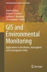
「GIS电子书」 GIS and Environmental Monitoring: Applications in the Marine, Atmospheric and Geomagnetic Fields(PDF版本)
这本书是对地理信息系统(GIS)的能力及其在环境相关应用和科学中的适用性和实用性进行研究和展示的重要贡献。重点是针对天气、海洋和大气环境以及地球磁场的集成基于WebGIS应用的设计、创建、开发和运行。本书旨在展示GIS在环境监测中的典型应用,包括用于生态映射海洋和港口相关参数、气候变化和地磁场的GIS解决方案。
在书的第一部分中,每个应用的描述包括用户需求、设计和开发阶段以及最终结果的展示、能力和服务。这些基于Web的应用程序是通过不同的创新方法开发的,如云GIS和Google Apps for GIS,证明了WebGIS在环境应用领域的价值。
书的第二部分概述了地球磁场参数,并揭示了使用GIS对地球磁场及其参数进行建模和分析的潜力。在这一部分,作者提出了一种新引入的现象,称为“地磁伪风暴”,并使用GIS技术和工具对其进行了建模和进一步分析。
本书适合对空间信息至关重要的各个领域感兴趣的人(例如社会和经济研究和制图、环境和气候研究、决策支持系统、公共服务,特别是地磁场变化和自然灾害预警系统设计)。它提供了使用创新技术、程序和WebGIS工具可视化和分析空间信息的现代方法和方法。在这本书中,读者将在设计和开发自己的WebGIS应用方面找到一个有价值的伴侣,因为它包含了关于监测海洋和大气环境以及处理气象问题和地球磁场以及太阳活动(空间天气信息)的应用程序的开发(Web)GIS应用的有用示例。本书还可以作为与上述领域相关的研究生、研究人员和专业人士的有用参考资料来源。
内容简介
This book constitutes a notable contribution to investigate and present the capabilities of Geographic Information Systems (GIS) and their applicability and usefulness in environmental-related applications and sciences. The focus is on the design, creation, development and operation of integrated Web-based GIS applications for weather, marine and atmospheric environments, and the Earth's magnetic field. More specifically, the aim of this book is to present characteristic applications of GIS to environmental monitoring including GIS solutions for eco-mapping sea and port-related parameters, climate changes, and geomagnetic field. In the first part of the book, the description of every application includes the user requirements, the design and development stages performed and the presentation of the final outcome, its capabilities and services. The Web-based applications are developed through different innovative approaches, such as cloud GIS and Google Apps for GIS, justifying the merit of WebGIS in the world of the environmental applications. The second part of the book provides an overview of geomagnetic field parameters and reveals the potential of using GIS for modeling and analyzing of the Earth's magnetic (geomagnetic) field and its parameters. Here, the authors present the recently introduced phenomenon called “geomagnetic pseudostorm”, which is modeled and further analyzed here with GIS technology and tools. This book appeals to those interested in various areas where spatial information becomes of paramount relevance (e.g. social and economic research and mapping, environmental and climate research, decision support systems, public services, and especially for geomagnetic field variations and for the design of warning systems for natural disasters). It presents modern methods and approaches to visualize and analyze spatial information using innovative techniques, procedures, and tools of WebGIS technology. In this book, the readers find a valuable companion in their efforts to design and develop their own WebGIS applications, as it includes useful examples of developing (Web)GIS applications regarding the monitoring of marine and atmospheric environments, as well as applications that deal with meteorological issues and the Earth’s magnetic field along with solar activity (space weather information).This book can also serve as a useful reference source for graduates, researchers and professionals related to the areas indicated above.
基础信息

作者: Stavros Kolios, Andrei V. Vorobev, Gulnara R. Vorobeva, Chrysostomos Stylios (auth.)
Series: Geotechnologies and the Environment 20
出版商: Springer International Publishing
出版时间: 2017
下载本书
 为了防止资源恶意爬取导致被和谐,此处内容被作者隐藏。
关注本站微信公众号,回复“资源下载”,获取验证码。
在微信里搜索“麻辣GIS”或微信扫描右侧二维码即可关注本站微信公众号。
求书 & 分享
如果这里没找到您所以需要的书籍,可以在本文下方留言,并留下您的邮箱,后续有相关资源后会分享给你。
如果您也有相应的书籍可以分享,可以将分享链接放在本文下方留言板中,替其他小伙伴先谢谢你啦~
相关阅读
声明
1.本文所分享的所有需要用户下载使用的内容(包括但不限于软件、数据、图片)来自于网络或者麻辣GIS粉丝自行分享,版权归该下载资源的合法拥有者所有,如有侵权请第一时间联系本站删除。
2.下载内容仅限个人学习使用,请切勿用作商用等其他用途,否则后果自负。


![[WebGIS] HTML5跟踪GPS轨迹笔记汇总](http://image.malagis.com/pic/gis/2016-09-24_21_12_57_1474722777.75992.jpg?imageView2/1/w/100/h/70)


